When large-scale event crowds disperse or road accidents occur, traffic control authorities face tight windows to evaluate traffic flows, pinpoint congestion hotspots, and assign alternative evacuation routes. While conventional navigation software offers general driving suggestions, it rarely factors in real-time traffic restrictions, vehicle-specific right-of-way rules, or municipal emergency management protocols.
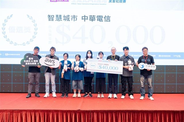
To bridge this gap, team "Inspiration Mushroom" created an intelligent traffic evacuation platform based on real-time traffic data, open public datasets, and digital twins. Competing in the "Chunghwa Telecom: Smart City" category, the team won top honors at the 2026 Taiwan Generative AI Applications Hackathon, organized by DIGITIMES under the guidance of the Administration for Digital Industries (ADI), Ministry of Digital Affairs (MODA). Amazon Web Services (AWS) served as the AI technology provider, delivering the generative AI and cloud services that powered the solutions.
Factoring in Scooter Right-of-Way via Digital Twins
Standard navigation applications calculate routes based on universal road conditions, making it difficult to account for temporary controls or vehicle-specific regulations. In Taiwan, where scooter density is exceptionally high, traffic rules for two-wheelers are significantly more complex than those for passenger cars—including two-stage left turns (hook turns), restricted lanes, and specific intersection rules. Without these factors, an evacuation route that looks feasible on paper may violate real-world right-of-way regulations.
To tackle this, the team embedded vehicle-specific traffic logic into its routing algorithm, generating tailored evacuation paths for both cars and scooters. The platform integrates Chunghwa Telecom's challenge dataset with Taipei City's open traffic data to analyze vehicle speeds, congestion density, and overall flow. These inputs are visualized through interactive Digital Twins on a centralized dashboard. Operators can monitor vehicle speeds in real time, with heavily congested segments automatically highlighted in red for rapid identification.
AI as Decision Support, Humans in Final Control
The team emphasizes that the AI system is designed to assist, not replace, human operators. Urban traffic conditions frequently diverge from standard operating procedures. Fully automated decision-making risks generating impractical routes if relying on incomplete data during rapidly evolving crises. Consequently, the AI handles data aggregation, situational analysis, and option generation, leaving final tactical decisions to experienced control room staff.
On the technical front, aligning spatial map layers with dynamic traffic data proved challenging. Coordinate offsets initially caused vehicle markers to drift off roads or float over buildings. Through iterative fine-tuning during the 30-hour sprint, the team stabilized the spatial rendering.
For urban management agencies, the system's core value lies in unifying fragmented traffic data and emergency response workflows into a single operational view. The team noted that building viable smart city solutions requires more than powerful AI models - it demands a deep understanding of localized traffic regulations, data precision limits, and real-world human decision-making workflows.