

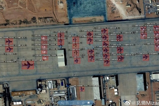
Chinese geospatial intelligence firm MizarVision has drawn scrutiny after publishing high-resolution commercial satellite imagery tracking US military aircraft and naval assets involved in operations against Iran, highlighting how commercially available...
The article requires paid subscription.
Subscribe Now